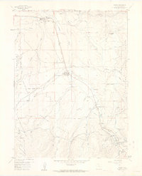
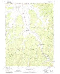
1957 Map of Fraser
USGS Topo · Published 1963About this map
The Fraser River valley serves as a critical corridor for transportation and water management in the late 1950s. The Denver and Rio Grande Western railroad tracks parallel the river, leading south toward the engineering feat of the Moffat Tunnel at West Portal. This area reflects the mid-century growth of mountain recreation and infrastructure, with Winter Park and Hideaway Park established along the valley floor. To the north, Tabernash and Fraser represent older settlement hubs supported by the rail line. The surrounding Arapaho National Forest is heavily marked by water diversion systems, including the Big Six Ditch and various aqueducts that trace the contours of the high terrain, demonstrating the complex efforts to capture and redirect snowmelt from the western slope.
Find a feature on this map
47 named features on this map. Tap any name to fly to it.
Don’t see what you’re looking for? This feature index may not catch every label — zoom into the map to look around manually.
Map Details
Editions of this 1957 Fraser Map
5 editions found
Other maps of this area

1905 · Central City
USGS Topo · 1:62,500

1910 · Central City
USGS Topo · 1:62,500

1912 · Central City
USGS Topo · 1:62,500

1915 · Longs Peak
USGS Topo · 1:125,000

1919 · Rocky Mountain National Park
USGS Topo · 1:125,000

1924 · Fraser
USGS Topo · 1:62,500

1926 · Fraser
USGS Topo · 1:62,500

1953 · Denver
USGS Topo · 1:250,000

1954 · Greeley
USGS Topo · 1:250,000

1957 · Denver
USGS Topo · 1:250,000