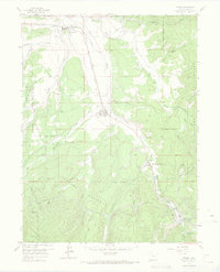
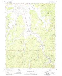
1957 Map of Fraser
USGS Topo · Published 1972About this map
The Fraser River valley and its surrounding high-country slopes are defined here by a mid-century infrastructure of rail, water, and recreation. The Denver and Rio Grande Western railroad serves as the spine of the valley, threading through Tabernash and Fraser before entering the Moffat Tunnel at West Portal. This engineering feat is complemented by the Arapahoe Aqueduct and associated tunnels, illustrating the region's critical role in water management and transport.
Find a feature on this map
47 named features on this map. Tap any name to fly to it.
Don’t see what you’re looking for? This feature index may not catch every label — zoom into the map to look around manually.
Map Details
Editions of this 1957 Fraser Map
5 editions found
Other maps of this area

1905 · Central City
USGS Topo · 1:62,500

1910 · Central City
USGS Topo · 1:62,500

1912 · Central City
USGS Topo · 1:62,500

1915 · Longs Peak
USGS Topo · 1:125,000

1919 · Rocky Mountain National Park
USGS Topo · 1:125,000

1924 · Fraser
USGS Topo · 1:62,500

1926 · Fraser
USGS Topo · 1:62,500

1953 · Denver
USGS Topo · 1:250,000

1954 · Greeley
USGS Topo · 1:250,000

1957 · Denver
USGS Topo · 1:250,000