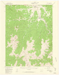
1957 Map of Fraser
USGS Topo · Published 1960About this map
The Fraser River corridor serves as the primary artery through this high-altitude landscape, where the Denver and Rio Grande Western railroad and U.S. 40 parallel the waterway through Fraser and Tabernash. In the late 1950s, the region was defined by its integration into the national forest system, evidenced by the Fraser Experimental Station and numerous recreational sites like the Idlewild Campground and the developing Ski Area near Berthoud Pass. The map details the complex drainage of the Arapaho National Forest, with St Louis Creek and Vasquez Creek carving deep into the surrounding peaks. High-elevation landmarks such as Byers Peak and Mt Nystrom anchor the western and southern boundaries, while the Hideaway Park Cem and the settlement at Winter Park indicate the era's growing focus on mountain tourism and permanent local infrastructure.
Find a feature on this map
91 named features on this map. Tap any name to fly to it.
Don’t see what you’re looking for? This feature index may not catch every label — zoom into the map to look around manually.
Map Details
Editions of this 1957 Fraser Map
4 editions found
Other maps of this area

1903 · Georgetown
USGS Topo · 1:62,500

1905 · Central City
USGS Topo · 1:62,500

1905 · Georgetown
USGS Topo · 1:62,500

1910 · Central City
USGS Topo · 1:62,500

1912 · Central City
USGS Topo · 1:62,500

1915 · Longs Peak
USGS Topo · 1:125,000

1919 · Rocky Mountain National Park
USGS Topo · 1:125,000

1924 · Montezuma
USGS Topo · 1:62,500

1924 · Fraser
USGS Topo · 1:62,500

1926 · Fraser
USGS Topo · 1:62,500