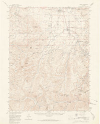
1957 Map of Fraser
USGS Topo · Published 1965About this map
Fraser and the surrounding high-altitude basin of Grand Co are defined by a complex network of water management and alpine transportation in the late 1950s. The Fraser River flows north toward Tabernash, paralleled by the Denver and Rio Grande Western railroad line. This era captures the critical infrastructure of the Continental Divide, featuring the Gumlick Tunnel and Vasquez Tunnel No 1, which divert water beneath the peaks of the Arapaho National Forest.
Find a feature on this map
104 named features on this map. Tap any name to fly to it.
Don’t see what you’re looking for? This feature index may not catch every label — zoom into the map to look around manually.
Map Details
Editions of this 1957 Fraser Map
4 editions found
Other maps of this area

1903 · Georgetown
USGS Topo · 1:62,500

1905 · Central City
USGS Topo · 1:62,500

1905 · Georgetown
USGS Topo · 1:62,500

1910 · Central City
USGS Topo · 1:62,500

1912 · Central City
USGS Topo · 1:62,500

1915 · Longs Peak
USGS Topo · 1:125,000

1919 · Rocky Mountain National Park
USGS Topo · 1:125,000

1924 · Montezuma
USGS Topo · 1:62,500

1924 · Fraser
USGS Topo · 1:62,500

1926 · Fraser
USGS Topo · 1:62,500