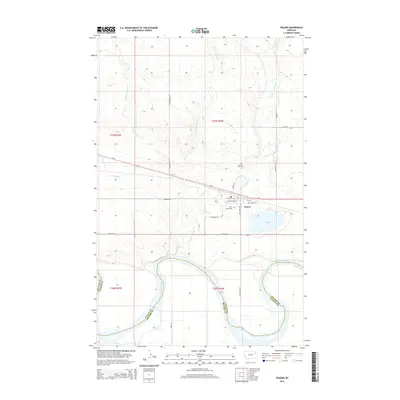
2014 Map of Frazer
USGS Topo · Published 2014About this map
The settlement of Frazer sits in the heart of this landscape, positioned along the northern bank of the Missouri River in the Fort Peck Indian Reservation area. The town’s grid is clearly defined by local thoroughfares such as Main St and Assiniboine St, with the southern edge of the community bordered by the waters of Frazer Lake. The map illustrates a transition from the structured residential blocks of the town to the surrounding agricultural and open lands, marked by family-named routes like McConnell Rd and Hentges Rd.
Find a feature on this map
32 named features on this map. Tap any name to fly to it.
Don’t see what you’re looking for? This feature index may not catch every label — zoom into the map to look around manually.
Map Details
Editions of this 2014 Frazer Map
This is the sole edition of this map. No revisions or reprints were ever made.
Other maps of this area

1915 · Frazer
USGS Topo · 1:62,500

1915 · Oswego
USGS Topo · 1:62,500

1954 · Jordan
USGS Topo · 1:250,000

1954 · Glendive
USGS Topo · 1:250,000

1954 · Wolf Point
USGS Topo · 1:250,000

1954 · Glasgow
USGS Topo · 1:250,000

1956 · Jordan
USGS Topo · 1:250,000

1957 · Glasgow
USGS Topo · 1:250,000

1957 · Glendive
USGS Topo · 1:250,000

1958 · Wolf Point
USGS Topo · 1:250,000