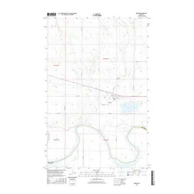
2017 Map of Frazer
USGS Topo · Published 2017About this map
Frazer serves as a focal point in this 2017 survey, situated north of the expansive Missouri River in Valley County. The township layout is clearly defined by local thoroughfares such as Main St, Lynn St, and Moccasin Dr, reflecting a structured community arrangement. For those researching local heritage, the presence of Saint Joseph Cem and Sunset Rest Cem provides important genealogical anchors within the settlement.
Find a feature on this map
29 named features on this map. Tap any name to fly to it.
Don’t see what you’re looking for? This feature index may not catch every label — zoom into the map to look around manually.
Map Details
Editions of this 2017 Frazer Map
This is the sole edition of this map. No revisions or reprints were ever made.
Other maps of this area

1915 · Frazer
USGS Topo · 1:62,500

1915 · Oswego
USGS Topo · 1:62,500

1954 · Jordan
USGS Topo · 1:250,000

1954 · Glendive
USGS Topo · 1:250,000

1954 · Wolf Point
USGS Topo · 1:250,000

1954 · Glasgow
USGS Topo · 1:250,000

1956 · Jordan
USGS Topo · 1:250,000

1957 · Glasgow
USGS Topo · 1:250,000

1957 · Glendive
USGS Topo · 1:250,000

1958 · Wolf Point
USGS Topo · 1:250,000