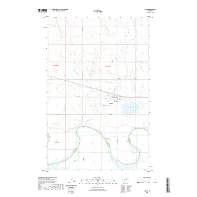
2020 Map of Frazer
USGS Topo · Published 2020About this map
Frazer serves as a central hub on this northern Montana landscape, situated near the transition from the rolling drainage basins of Charley Cr and Little Porcupine Creek to the broad valley of the Missouri River. The town's grid is defined by streets like Assiniboine St and Moccasin Dr, reflecting its regional heritage. To the east, Frazer Lake and several wetland areas provide a distinct contrast to the surrounding terrain, while the Lewis and Clark Trl follows the southern corridor near the riverbanks.
Find a feature on this map
32 named features on this map. Tap any name to fly to it.
Don’t see what you’re looking for? This feature index may not catch every label — zoom into the map to look around manually.
Map Details
Editions of this 2020 Frazer Map
This is the sole edition of this map. No revisions or reprints were ever made.
Other maps of this area

1915 · Frazer
USGS Topo · 1:62,500

1915 · Oswego
USGS Topo · 1:62,500

1954 · Jordan
USGS Topo · 1:250,000

1954 · Glendive
USGS Topo · 1:250,000

1954 · Wolf Point
USGS Topo · 1:250,000

1954 · Glasgow
USGS Topo · 1:250,000

1956 · Jordan
USGS Topo · 1:250,000

1957 · Glasgow
USGS Topo · 1:250,000

1957 · Glendive
USGS Topo · 1:250,000

1958 · Wolf Point
USGS Topo · 1:250,000