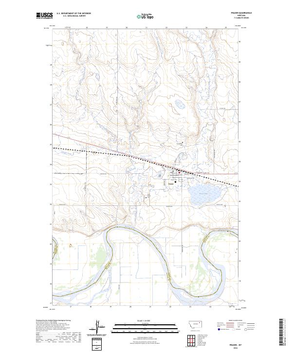
2024 Map of Frazer
USGS Topo · Published 2024About this map
Frazer sits as a central hub on this landscape, positioned north of a major bend in the Missouri River where the boundary between Valley Co and McCone Co follows the water's edge. The settlement is anchored by local landmarks such as Saint Joseph Cem and Sunset Rest Cem, reflecting a long-standing community presence. Transportation routes like the Lewis and Clark Trl and Indian Hwy traverse the area, connecting the town to the surrounding prairie. To the east, Frazer Lake provides a distinct hydrologic feature, while a network of drainage systems including Little Porcupine Creek and various forks of Charley Creek define the local topography. Genealogists may find the Clark Family Cem particularly notable, located just south of the main town site amidst a grid of rural roads like Hentges Rd and Ferry Rd.
Find a feature on this map
29 named features on this map. Tap any name to fly to it.
Don’t see what you’re looking for? This feature index may not catch every label — zoom into the map to look around manually.
Map Details
Editions of this 2024 Frazer Map
This is the sole edition of this map. No revisions or reprints were ever made.
Other maps of this area

1915 · Frazer
USGS Topo · 1:62,500

1915 · Oswego
USGS Topo · 1:62,500

1954 · Jordan
USGS Topo · 1:250,000

1954 · Glendive
USGS Topo · 1:250,000

1954 · Wolf Point
USGS Topo · 1:250,000

1954 · Glasgow
USGS Topo · 1:250,000

1956 · Jordan
USGS Topo · 1:250,000

1957 · Glasgow
USGS Topo · 1:250,000

1957 · Glendive
USGS Topo · 1:250,000

1958 · Wolf Point
USGS Topo · 1:250,000