
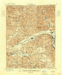
1910 Map of Frazeysburg
USGS Topo · Published 1937About this map
The Licking River and Muskingum River converge near the eastern edge of this region, shaping a landscape defined by sharp ridges and deep runs. This early 20th-century survey documents a transition in transportation, showing the industrial footprint of the Pennsylvania System and the Baltimore and Ohio RR alongside the bypasses of the Ohio Canal (Abandoned). The settlement at Frazeysburg serves as a central hub, while rural life is anchored by a dense network of country institutions, including Chalfant Church and family-named landmarks like Stump Hill.
Find a feature on this map
108 named features on this map. Tap any name to fly to it.
Don’t see what you’re looking for? This feature index may not catch every label — zoom into the map to look around manually.
Map Details
Editions of this 1910 Frazeysburg Map
2 editions found
Other maps of this area

1908 · Conesville
USGS Topo · 1:62,500

1909 · Newark
USGS Topo · 1:62,500

1909 · Thornville
USGS Topo · 1:62,500

1910 · Philo
USGS Topo · 1:62,500

1910 · Zanesville
USGS Topo · 1:62,500

1910 · Conesville
USGS Topo · 1:62,500

1912 · Gambier
USGS Topo · 1:62,500

1913 · Brinkhaven
USGS Topo · 1:62,500

1913 · Coshocton
USGS Topo · 1:62,500

1914 · Gambier
USGS Topo · 1:62,500