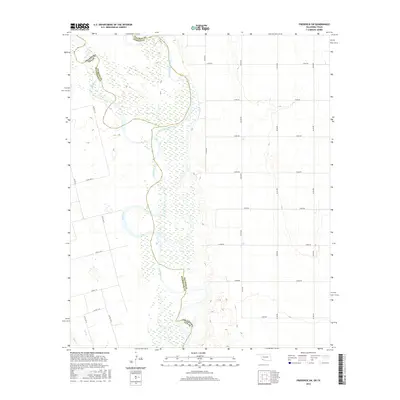
2016 Map of Frederick SW
USGS Topo · Published 2016About this map
The Red River and its North Fork Red River converge in this borderlands region, where the shifting sands of the riverbed define the boundary between Oklahoma and Texas. The landscape is dominated by the wide, braided channels of these major watercourses, which meander through a series of counties including Jackson, Tillman, and Wilbarger. This 2016 survey illustrates a largely rural expanse divided by a systematic grid of section roads, such as N2120 Rd and E1870 Rd, which provide access to the agricultural lands and riparian corridors. Small tributaries like Salt Cr feed into the primary river system, highlighting the hydrological importance of this area in the Great Plains. The map's detail provides a clear view of the complex county lines that follow the historical, winding path of the river, offering a precise look at how property and political divisions are tied to the local geography.
Find a feature on this map
27 named features on this map. Tap any name to fly to it.
Don’t see what you’re looking for? This feature index may not catch every label — zoom into the map to look around manually.
Map Details
Editions of this 2016 Frederick SW Map
This is the sole edition of this map. No revisions or reprints were ever made.
Other maps of this area

1955 · Lawton
USGS Topo · 1:250,000

1958 · Davidson
USGS Topo · 1:62,500

1958 · Frederick
USGS Topo · 1:62,500

1958 · Vernon
USGS Topo · 1:62,500

1958 · Elmer
USGS Topo · 1:62,500

1975 · Elmore City NE
USGS Topo · 1:24,000

1975 · Frederick NE
USGS Topo · 1:24,000

1975 · Frederick SW
USGS Topo · 1:24,000

1975 · Frederick NW
USGS Topo · 1:24,000

1975 · Frederick SE
USGS Topo · 1:24,000