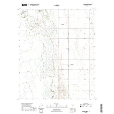
2018 Map of Frederick SW
USGS Topo · Published 2018About this map
The Red River defines the landscape of this Oklahoma-Texas border region, where its wide, braided channel carves through the transition between Jackson Co and Wilbarger Co. The confluence where the North Fork Red River joins the main stem dominates the northern section, creating a complex wetland environment of sandbars and shifting watercourses. To the west, the smaller Salt Cr feeds into the river system. The surrounding terrain is organized by a rigid grid of rural county roads, such as Co RD 111 N and e1830 RD, reflecting the agricultural land management of the early 21st century. This survey documents the interplay between the dynamic river borders and the fixed section lines of the Public Land Survey System, specifically within t2s r19w and t3s r19w.
Find a feature on this map
63 named features on this map. Tap any name to fly to it.
Don’t see what you’re looking for? This feature index may not catch every label — zoom into the map to look around manually.
Map Details
Editions of this 2018 Frederick SW Map
This is the sole edition of this map. No revisions or reprints were ever made.
Other maps of this area

1955 · Lawton
USGS Topo · 1:250,000

1958 · Davidson
USGS Topo · 1:62,500

1958 · Frederick
USGS Topo · 1:62,500

1958 · Vernon
USGS Topo · 1:62,500

1958 · Elmer
USGS Topo · 1:62,500

1975 · Elmore City NE
USGS Topo · 1:24,000

1975 · Frederick NE
USGS Topo · 1:24,000

1975 · Frederick SW
USGS Topo · 1:24,000

1975 · Frederick NW
USGS Topo · 1:24,000

1975 · Frederick SE
USGS Topo · 1:24,000