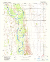
1984 Map of Frederick SW
USGS Topo · Published 1985About this map
The Red River creates a shifting natural boundary at the intersection of Tillman, Jackson, and Wilbarger counties in the early 1980s. This survey illustrates the intricate braided channels and sandbars characteristic of the river's path, where an Indefinite Boundary marks the complex division between Oklahoma and Texas. To the north, the North Fork joins the main stem amidst a landscape punctuated by the Richland terrain. The area is defined by a heavy reliance on groundwater and mineral extraction, evidenced by numerous Wells and scattered Oil Wells across the floodplains. To the southwest, Salt Creek feeds into the river system, highlighting the hydrological patterns of the Red River Valley before modern channel stabilization or further agricultural development altered the immediate riparian environment.
Find a feature on this map
12 named features on this map. Tap any name to fly to it.
Don’t see what you’re looking for? This feature index may not catch every label — zoom into the map to look around manually.
Map Details
Editions of this 1984 Frederick SW Map
This is the sole edition of this map. No revisions or reprints were ever made.
Other maps of this area

1955 · Lawton
USGS Topo · 1:250,000

1958 · Davidson
USGS Topo · 1:62,500

1958 · Frederick
USGS Topo · 1:62,500

1958 · Vernon
USGS Topo · 1:62,500

1958 · Elmer
USGS Topo · 1:62,500

1975 · Elmore City NE
USGS Topo · 1:24,000

1975 · Frederick NE
USGS Topo · 1:24,000

1975 · Frederick SW
USGS Topo · 1:24,000

1975 · Frederick NW
USGS Topo · 1:24,000

1975 · Frederick SE
USGS Topo · 1:24,000