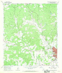
1967 Map of Fredericksburg West
USGS Topo · Published 1970About this map
Fredericksburg and the surrounding Gillespie County hill country are documented during a period of steady local growth in the late 1960s. The town's grid is well-established, showing the Fairground, an Athletic Field, and the National Guard Armory. Cultural landmarks like St Mary Cem sit on the edge of the expanding residential area, while the rural landscape is defined by family-named terrain like Schlaudt Hills and Hotopp Hills.
Find a feature on this map
51 named features on this map. Tap any name to fly to it.
Don’t see what you’re looking for? This feature index may not catch every label — zoom into the map to look around manually.
Map Details
Editions of this 1967 Fredericksburg West Map
2 editions found
Other maps of this area

1894 · Fredericksburg
USGS Topo · 1:125,000

1894 · Kerrville
USGS Topo · 1:125,000

1954 · Llano
USGS Topo · 1:250,000

1955 · Llano
USGS Topo · 1:250,000

1956 · Llano
USGS Topo · 1:250,000

1963 · Cain City
USGS Topo · 1:24,000

1964 · Oak Crest Park
USGS Topo · 1:24,000

1964 · Morris Ranch
USGS Topo · 1:24,000
1967 · Cherry Mountain
USGS Topo · 1:24,000

1967 · Fredericksburg East
USGS Topo · 1:24,000