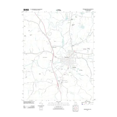
2011 Map of Fredericktown
USGS Topo · Published 2011About this map
Fredericktown serves as the hub of this Madison County landscape, where the Little Saint Francis River meets a network of local roads and water bodies shaped by centuries of mining activity. The northern reaches of the map are defined by the legacy of Mine La Motte, featuring extensive water management sites like Mine La Motte Reservoir, Mine Lamotte Lake, and the tellingly named Slime Pond. These industrial imprints contrast with the surrounding elevations of Buckner Mountain and Mount Devon.
Find a feature on this map
83 named features on this map. Tap any name to fly to it.
Don’t see what you’re looking for? This feature index may not catch every label — zoom into the map to look around manually.
Map Details
Editions of this 2011 Fredericktown Map
This is the sole edition of this map. No revisions or reprints were ever made.
Other maps of this area

1910 · Higdon
USGS Topo · 1:62,500

1930 · Coldwater
USGS Topo · 1:62,500

1933 · Marquand
USGS Topo · 1:62,500

1938 · Marquand
USGS Topo · 1:62,500

1939 · Fredericktown
USGS Topo · 1:48,000

1947 · Fredericktown
USGS Topo · 1:62,500

1949 · Rolla
USGS Topo · 1:250,000

1949 · Coldwater
USGS Topo · 1:62,500

1950 · Fredericktown
USGS Topo · 1:62,500

1953 · Rolla
USGS Topo · 1:250,000