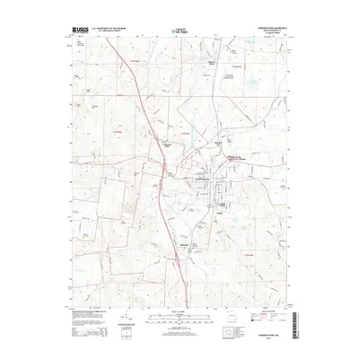
2015 Map of Fredericktown
USGS Topo · Published 2015About this map
Fredericktown and the surrounding Madison County landscape are defined by a complex network of waterways including the Little Saint Francis River, Saline Creek, and Mill Creek. This 2015 record shows the area's continued evolution from its early mining origins, visible in the cluster of settlements like Mine La Motte, Cobalt Village, and Catherine Place. The topographic detail reveals the eastern edges of the Saint Francois Mountains, with local peaks such as Bald Mountain and Vogel Hill rising above the river valleys.
Find a feature on this map
162 named features on this map. Tap any name to fly to it.
Don’t see what you’re looking for? This feature index may not catch every label — zoom into the map to look around manually.
Map Details
Editions of this 2015 Fredericktown Map
This is the sole edition of this map. No revisions or reprints were ever made.
Other maps of this area

1910 · Higdon
USGS Topo · 1:62,500

1930 · Coldwater
USGS Topo · 1:62,500

1933 · Marquand
USGS Topo · 1:62,500

1938 · Marquand
USGS Topo · 1:62,500

1939 · Fredericktown
USGS Topo · 1:48,000

1947 · Fredericktown
USGS Topo · 1:62,500

1949 · Rolla
USGS Topo · 1:250,000

1949 · Coldwater
USGS Topo · 1:62,500

1950 · Fredericktown
USGS Topo · 1:62,500

1953 · Rolla
USGS Topo · 1:250,000