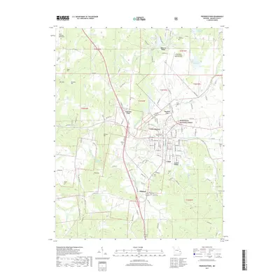
2017 Map of Fredericktown
USGS Topo · Published 2017About this map
Fredericktown serves as the central hub of this 2017 study, where the urban street grid meets the winding Saline Cr. The landscape is defined by its deep mining heritage, most notably at the historic Mine La Motte settlement to the north and the industrial footprint of Cobalt and Cobalt Village to the southeast. These sites, accompanied by features like Tailings Lake and Freshwater Lake, illustrate the long-term environmental and social impact of mineral extraction in the region.
Find a feature on this map
142 named features on this map. Tap any name to fly to it.
Don’t see what you’re looking for? This feature index may not catch every label — zoom into the map to look around manually.
Map Details
Editions of this 2017 Fredericktown Map
This is the sole edition of this map. No revisions or reprints were ever made.
Other maps of this area

1910 · Higdon
USGS Topo · 1:62,500

1930 · Coldwater
USGS Topo · 1:62,500

1933 · Marquand
USGS Topo · 1:62,500

1938 · Marquand
USGS Topo · 1:62,500

1939 · Fredericktown
USGS Topo · 1:48,000

1947 · Fredericktown
USGS Topo · 1:62,500

1949 · Rolla
USGS Topo · 1:250,000

1949 · Coldwater
USGS Topo · 1:62,500

1950 · Fredericktown
USGS Topo · 1:62,500

1953 · Rolla
USGS Topo · 1:250,000