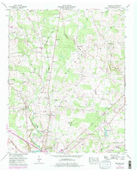
1956 Map of Fredonia
USGS Topo · Published 1977About this map
The Barren Fork Divide defines the upper reaches of Coffee County, where headwater streams like Goose Pond Creek and Welker Branch begin their descent. Near the southern edge of the sheet, the City Boundary of Manchester touches the Duck River, indicating the northward expansion of the town during the mid-20th century. This area is characterized by a dense network of family cemeteries and rural congregations, including Lumley Stand Ch and Patmos Chapel, which served the scattered farming communities on the Greenbrier Flat.
Find a feature on this map
46 named features on this map. Tap any name to fly to it.
Don’t see what you’re looking for? This feature index may not catch every label — zoom into the map to look around manually.
Map Details
Editions of this 1956 Fredonia Map
4 editions found
Other maps of this area

1893 · Mc Minnville
USGS Topo · 1:125,000

1895 · Mc Minnville
USGS Topo · 1:125,000

1895 · Sewanee
USGS Topo · 1:125,000

1913 · Hollow Springs
USGS Topo · 1:62,500

1936 · Ovoca
USGS Topo · 1:24,000

1936 · Fredonia
USGS Topo · 1:24,000

1936 · Manchester
USGS Topo · 1:24,000

1936 · Beech Grove
USGS Topo · 1:24,000

1936 · Petty Gap
USGS Topo · 1:24,000

1936 · Noah
USGS Topo · 1:24,000