
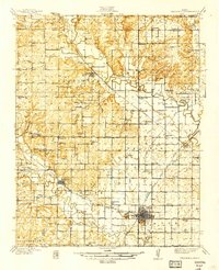
1939 Map of Fredonia
USGS Topo · Published 1939About this map
Fredonia serves as the regional hub at the confluence of the Fall River and the Verdigris River, anchoring a landscape defined by its river-and-rail economy in the late 1930s. The convergence of the Atchison Topeka and Santa Fe, St Louis San Francisco, and Missouri Pacific railroads highlights the area's importance for transit and agricultural shipping. Rural life is meticulously mapped through an exceptionally dense network of schoolhouses, such as Forty Four Sch, Ten Penny Sch, and Triumph Sch, illustrating the dispersed but organized settlement pattern of the era. The presence of Delaware Springs and numerous cemeteries like Old Tailor Cem provide specific points of interest for genealogists tracing local families across the townships of Webster, Prairie, and Center.
Find a feature on this map
73 named features on this map. Tap any name to fly to it.
Don’t see what you’re looking for? This feature index may not catch every label — zoom into the map to look around manually.
Map Details
Editions of this 1939 Fredonia Map
2 editions found
Other maps of this area

1885 · Eureka
USGS Topo · 1:125,000

1885 · Sedan
USGS Topo · 1:125,000

1886 · Fredonia
USGS Topo · 1:125,000

1886 · Independence
USGS Topo · 1:125,000

1888 · Eureka
USGS Topo · 1:125,000

1889 · Sedan
USGS Topo · 1:125,000

1894 · Fredonia
USGS Topo · 1:125,000

1894 · Independence
USGS Topo · 1:125,000

1894 · Eureka
USGS Topo · 1:125,000

1905 · Independence
USGS Topo · 1:125,000