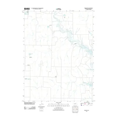
2011 Map of Freedom
USGS Topo · Published 2011About this map
Freedom anchors this Frontier County landscape, a region defined by its sophisticated water management systems along the drainage of Medicine Creek. The terrain is characterized by a series of engineered impoundments, including the substantial Harry Strunk Lake and smaller localized catchments such as Zysset Reservoir, Wood Reservoir, and Wauneta North Reservoir. These features, supported by structures like the Medicine Creek Dam 160 and Wauneta North Dam, illustrate the agricultural necessity of water storage in this part of Nebraska. For genealogists and local historians, the presence of the Gammill Cemetery and Prairie Land Cemetery provides specific points of interest among the winding courses of Walnut Creek, Lime Creek, and Shelly Creek. The map also traces local travel ways including Trail 5 and Trail 7, which navigate the draws and rises typical of this prairie geography.
Find a feature on this map
20 named features on this map. Tap any name to fly to it.
Don’t see what you’re looking for? This feature index may not catch every label — zoom into the map to look around manually.
Map Details
Editions of this 2011 Freedom Map
This is the sole edition of this map. No revisions or reprints were ever made.
Other maps of this area

1902 · Gothenburg
USGS Topo · 1:125,000

1954 · McCook
USGS Topo · 1:250,000

1956 · Freedom
USGS Topo · 1:24,000

1956 · Cambridge
USGS Topo · 1:24,000

1956 · Medicine Creek Dam
USGS Topo · 1:24,000

1956 · Stockville
USGS Topo · 1:24,000

1956 · Bartley NW
USGS Topo · 1:24,000

1956 · Bartley
USGS Topo · 1:24,000

1956 · Stockville SE
USGS Topo · 1:24,000

1957 · McCook
USGS Topo · 1:250,000