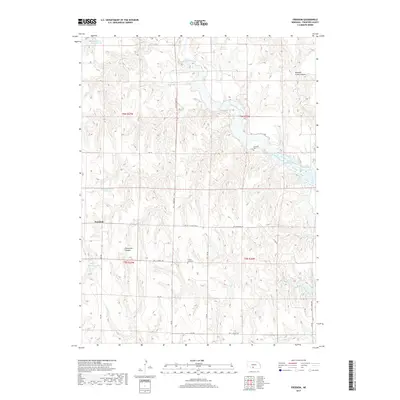
2017 Map of Freedom
USGS Topo · Published 2017About this map
Freedom serves as a central reference point in this portion of Frontier County, situated within a landscape carved by the drainage of Medicine Cr and Lime Cr. The terrain is defined by significant erosion patterns, most notably at Mitchell Creek Canyon and Stevenson Canyon, which interrupt the surrounding plateau. Water management is a dominant theme of this era, illustrated by the extensive reservoir system including Harry Strunk Lake, Wauneta North Reservoir, and several smaller impoundments like Zysset Reservoir. For those researching local heritage, the map identifies two rural burial grounds: Gammill Cem located near the banks of Medicine Creek, and Prairie Land Cem further south. This network of reservoirs and canyons, connected by a grid of rural routes such as Trl 5 / Road 728, provides a clear view of how irrigation and land use shaped this Nebraska ranching and farming country.
Find a feature on this map
32 named features on this map. Tap any name to fly to it.
Don’t see what you’re looking for? This feature index may not catch every label — zoom into the map to look around manually.
Map Details
Editions of this 2017 Freedom Map
This is the sole edition of this map. No revisions or reprints were ever made.
Other maps of this area

1902 · Gothenburg
USGS Topo · 1:125,000

1954 · McCook
USGS Topo · 1:250,000

1956 · Freedom
USGS Topo · 1:24,000

1956 · Cambridge
USGS Topo · 1:24,000

1956 · Medicine Creek Dam
USGS Topo · 1:24,000

1956 · Stockville
USGS Topo · 1:24,000

1956 · Bartley NW
USGS Topo · 1:24,000

1956 · Bartley
USGS Topo · 1:24,000

1956 · Stockville SE
USGS Topo · 1:24,000

1957 · McCook
USGS Topo · 1:250,000