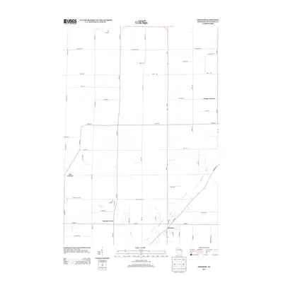
2013 Map of Freedom
USGS Topo · Published 2013About this map
The settlement of Freedom serves as the central hub of this agricultural and residential landscape in Outagamie County. The map documents a classic Midwestern crossroads pattern, anchored by distinct named intersections including Chicago Corners, Five Corners, and Murphy Corner. These points of interest, combined with a dense network of family-named thoroughfares such as Mielke Rd and Culbertson Rd, reflect the long-standing land divisions of this Wisconsin community. The natural geography is defined by the winding course of Duck Creek, which flows through the southern and eastern portions of the quadrangle. This 2013 survey provides a clear view of the rural-to-suburban transition, where established farmsteads and newer residential tracts align along arterial routes like Wi-55 and Co Hwy-C.
Find a feature on this map
47 named features on this map. Tap any name to fly to it.
Don’t see what you’re looking for? This feature index may not catch every label — zoom into the map to look around manually.
Map Details
Editions of this 2013 Freedom Map
This is the sole edition of this map. No revisions or reprints were ever made.
Other maps of this area

1954 · De Pere
USGS Topo · 1:62,500

1954 · Green Bay
USGS Topo · 1:62,500

1955 · Appleton
USGS Topo · 1:24,000

1955 · Appleton
USGS Topo · 1:62,500

1955 · Seymour
USGS Topo · 1:62,500

1955 · Green Bay
USGS Topo · 1:250,000

1974 · Seymour
USGS Topo · 1:24,000
1974 · Nichols
USGS Topo · 1:24,000

1974 · Kaukauna
USGS Topo · 1:24,000
1974 · Oneida South
USGS Topo · 1:24,000