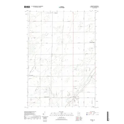
2018 Map of Freedom
USGS Topo · Published 2018About this map
The town of Freedom serves as the focal point of this Outagamie County landscape, where the agricultural grid is punctuated by historic crossroads and community institutions. Significant genealogical sites are concentrated near the settlement, including Saint Nicholas Cem and the Freedom Cem to the west. Further north, the boundary of Seymour appears alongside Saint John Catholic Cem, indicating the early religious and civic centers that defined local life.
Find a feature on this map
62 named features on this map. Tap any name to fly to it.
Don’t see what you’re looking for? This feature index may not catch every label — zoom into the map to look around manually.
Map Details
Editions of this 2018 Freedom Map
This is the sole edition of this map. No revisions or reprints were ever made.
Other maps of this area

1954 · De Pere
USGS Topo · 1:62,500

1954 · Green Bay
USGS Topo · 1:62,500

1955 · Appleton
USGS Topo · 1:24,000

1955 · Appleton
USGS Topo · 1:62,500

1955 · Seymour
USGS Topo · 1:62,500

1955 · Green Bay
USGS Topo · 1:250,000

1974 · Seymour
USGS Topo · 1:24,000
1974 · Nichols
USGS Topo · 1:24,000

1974 · Kaukauna
USGS Topo · 1:24,000
1974 · Oneida South
USGS Topo · 1:24,000