
1956 Map of Freedom
USGS Topo · Published 1958About this map
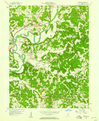
The White River carves a winding path through the center of this mid-century landscape, anchoring a series of small rural communities and family-named cemeteries. The town of Freedom sits along the western bank, served by the Pennsylvania railroad line and the Harrison Memorial Highway. Further inland, smaller settlements like New Hope, Pottersville, and Braysville are scattered among the ridges and valleys of Franklin and Clay townships. For genealogists, the map is particularly dense with burial sites, ranging from the Scott Cem in the north to the Livingston Cem near Richland Creek in the south. The presence of Grain Storage Bins near the railroad at Freedom and a cluster of Mills north of the river reflects the local agricultural and timber economy of the era, while topographic markers like Stokey Ridge and Kelley Ridge define the local upland terrain.
Find a feature on this map
47 named features on this map. Tap any name to fly to it.
Don’t see what you’re looking for? This feature index may not catch every label — zoom into the map to look around manually.
Map Details
Editions of this 1956 Freedom Map
5 editions found
Other maps of this area

1908 · Bloomington
USGS Topo · 1:48,000

1908 · Bloomfield
USGS Topo · 1:62,500

1910 · Bloomington
USGS Topo · 1:62,500

1947 · Gosport
USGS Topo · 1:24,000

1950 · Gosport
USGS Topo · 1:24,000

1950 · Arney
USGS Topo · 1:24,000

1951 · Bloomfield
USGS Topo · 1:24,000

1953 · Indianapolis
USGS Topo · 1:250,000

1956 · Indianapolis
USGS Topo · 1:250,000

1956 · Patricksburg
USGS Topo · 1:24,000