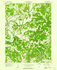
1956 Map of Freedom
USGS Topo · Published 1968About this map
The White River carves a deep, winding path through this mid-century portrait of the Owen and Greene County borderlands. The town of Freedom sits near a prominent bend, where the Pennsylvania railroad tracks parallel the water’s edge. This 1956 landscape is defined by its numerous small burial grounds and rural hubs like Pottersville, Adel, and New Hope, reflecting a decentralized settlement pattern common to this part of Indiana before the era of major highway consolidation.
Find a feature on this map
46 named features on this map. Tap any name to fly to it.
Don’t see what you’re looking for? This feature index may not catch every label — zoom into the map to look around manually.
Map Details
Editions of this 1956 Freedom Map
5 editions found

Other maps of this area

1908 · Bloomington
USGS Topo · 1:48,000

1908 · Bloomfield
USGS Topo · 1:62,500

1910 · Bloomington
USGS Topo · 1:62,500

1947 · Gosport
USGS Topo · 1:24,000

1950 · Gosport
USGS Topo · 1:24,000

1950 · Arney
USGS Topo · 1:24,000

1951 · Bloomfield
USGS Topo · 1:24,000

1953 · Indianapolis
USGS Topo · 1:250,000

1956 · Indianapolis
USGS Topo · 1:250,000

1956 · Patricksburg
USGS Topo · 1:24,000