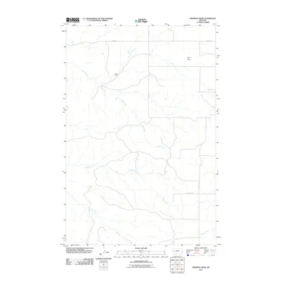
2011 Map of Freeman Creek
USGS Topo · Published 2011About this map
Hodges Creek and Glendive Creek dominate this eastern Montana landscape, illustrating the drainage patterns of the high plains in Dawson County. The map provides a look at the rural infrastructure as it existed in the early 21st century, defined by a grid of local routes such as Hodges Rd and Baird Butte Rd. A significant transport element is the rail line running through the northern section, featuring Heckman Siding and Beaver Hill Siding. These sidings represent the vital link between the isolated agricultural operations of the region and the broader rail network. Further south, Freeman Creek and Spring Creek meander through the prairie, where large parcels of land are accessed by roads like Anvil Butte Rd and Yates Rd W, showing a topography shaped by both natural watercourses and the orderly divisions of the township and range system.
Find a feature on this map
11 named features on this map. Tap any name to fly to it.
Don’t see what you’re looking for? This feature index may not catch every label — zoom into the map to look around manually.
Map Details
Editions of this 2011 Freeman Creek Map
This is the sole edition of this map. No revisions or reprints were ever made.
Other maps of this area

1909 · Glendive
USGS Topo · 1:250,000

1953 · Miles City
USGS Topo · 1:250,000

1954 · Glendive
USGS Topo · 1:250,000

1957 · Miles City
USGS Topo · 1:250,000

1957 · Glendive
USGS Topo · 1:250,000

1958 · Miles City
USGS Topo · 1:250,000

1958 · Glendive
USGS Topo · 1:250,000

1981 · Glendive
USGS Topo · 1:100,000

1981 · Wibaux
USGS Topo · 1:100,000
1982 · Hodges SE
USGS Topo · 1:24,000