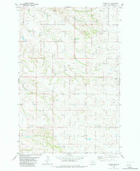
1982 Map of Hodges SE
USGS Topo · Published 1982About this map
The high plains of eastern Montana's borderlands are defined by the winding drainages of Wolf Creek and Horse Creek in this 1982 map. These intermittent waterways and the surrounding topography reflect the working ranching landscape of the late twentieth century, where water access was managed through features like Flowing Well and various springs. The map documents the region's transition between township and range lines, specifically where R 58 E meets T 13 N, a detail essential for land title researchers and genealogists tracing property records in Wibaux County. Aside from these natural features, the presence of a Radio Tower stands as one of the few modern industrial landmarks in this largely undeveloped terrain, illustrating how communication infrastructure integrated into the rural West.
Find a feature on this map
8 named features on this map. Tap any name to fly to it.
Don’t see what you’re looking for? This feature index may not catch every label — zoom into the map to look around manually.
Map Details
Editions of this 1982 Hodges SE Map
This is the sole edition of this map. No revisions or reprints were ever made.
Other maps of this area

1953 · Miles City
USGS Topo · 1:250,000

1957 · Miles City
USGS Topo · 1:250,000

1958 · Miles City
USGS Topo · 1:250,000

1981 · Cap Rock
USGS Topo · 1:24,000

1981 · Rocking Chair Butte
USGS Topo · 1:24,000
1981 · Carlyle NW
USGS Topo · 1:24,000

1981 · Wibaux
USGS Topo · 1:100,000

1982 · Hodges
USGS Topo · 1:24,000
1982 · Red Top Butte
USGS Topo · 1:24,000
1982 · Freeman Creek
USGS Topo · 1:24,000