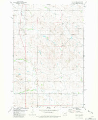
1981 Map of Carlyle NW
USGS Topo · Published 1981About this map
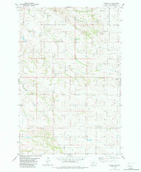
Beaver Creek and its southern drainage, East Fork Beaver Creek, shape the rolling landscape along the border of Wibaux and Fallon counties in eastern Montana. This 1981 survey documents a sparsely populated rangeland characterized by intermittent watercourses like Lone Tree Creek and Rattlesnake Creek. Modern industrial activity is evidenced by an extensive Pipeline that traverses the central terrain and a Gravel Pit located near the southern boundary. For researchers, the map provides precise locations for numerous wells scattered throughout the hills, reflecting the region's historical reliance on groundwater for livestock and remote homesteads. The convergence of Ash Creek with larger drainage systems highlights the topographic complexity of this high plains environment during the late twentieth century.
Find a feature on this map
10 named features on this map. Tap any name to fly to it.
Don’t see what you’re looking for? This feature index may not catch every label — zoom into the map to look around manually.
Map Details
Editions of this 1981 Carlyle NW Map
This is the sole edition of this map. No revisions or reprints were ever made.
Other maps of this area

1953 · Miles City
USGS Topo · 1:250,000

1957 · Miles City
USGS Topo · 1:250,000

1958 · Miles City
USGS Topo · 1:250,000

1981 · Cap Rock
USGS Topo · 1:24,000
1981 · Shell Butte
USGS Topo · 1:24,000

1981 · Carlyle
USGS Topo · 1:24,000
1981 · Rush Hall Reservoir
USGS Topo · 1:24,000
1981 · Ollie
USGS Topo · 1:24,000

1981 · Wibaux
USGS Topo · 1:100,000
1982 · Hodges SE
USGS Topo · 1:24,000