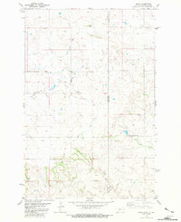
1981 Map of Ollie
USGS Topo · Published 1981About this map
Ollie sits at the intersection of prairie drainage systems and state lines in this early 1980s topographical study. The map documents a landscape defined by its hydrography, where Beaver Creek and Bull Run carve paths through the borderlands of Fallon County and Golden Valley County. A significant historical marker is the Old Railroad Grade, which traces a path through the western sections of the map, signifying the importance of rail transit in the region's earlier development. Evidence of resource exploration appears with the presence of a Drill Hole and numerous Well sites scattered across the terrain. The meeting of Horse Creek and Mud Creek further south highlights the complex network of seasonal watercourses that shaped local ranching and settlement patterns during this era.
Find a feature on this map
15 named features on this map. Tap any name to fly to it.
Don’t see what you’re looking for? This feature index may not catch every label — zoom into the map to look around manually.
Map Details
Editions of this 1981 Ollie Map
This is the sole edition of this map. No revisions or reprints were ever made.
Other maps of this area

1953 · Miles City
USGS Topo · 1:250,000

1953 · Dickinson
USGS Topo · 1:250,000

1957 · Dickinson
USGS Topo · 1:250,000

1957 · Miles City
USGS Topo · 1:250,000

1958 · Miles City
USGS Topo · 1:250,000

1980 · Golva
USGS Topo · 1:24,000

1980 · Pretty Butte
USGS Topo · 1:24,000

1980 · Belfield
USGS Topo · 1:100,000

1981 · Baker
USGS Topo · 1:100,000
1981 · Morris Butte
USGS Topo · 1:24,000