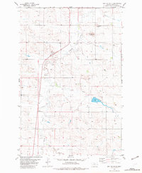
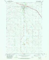
1982 Map of Red Top Butte
USGS Topo · Published 1982About this map
Red Top Butte and Jackrabbit Butte rise as prominent landmarks in this eastern Montana landscape, where the drainages of Beaver Creek and Lame Steer Creek carve through the high plains. The map documents a sparsely populated ranching and agricultural region during the early 1980s, characterized by isolated homesteads and essential community hubs. Rural life is anchored by institutional landmarks such as St Philip Ch and the South Center Sch, which served the families living along the winding banks of Duck Creek and Lone Tree Creek. Natural resources and small-scale industry are evidenced by a Gravel Pit and numerous Well sites scattered across the township, while Horse Point marks a distinct geographic feature in the western portion of the quadrangle. This detailed topographic study preserves the placement of property boundaries and section lines that define the organized settlement pattern of Wibaux County.
Find a feature on this map
12 named features on this map. Tap any name to fly to it.
Don’t see what you’re looking for? This feature index may not catch every label — zoom into the map to look around manually.
Map Details
Editions of this 1982 Red Top Butte Map
This is the sole edition of this map. No revisions or reprints were ever made.
Other maps of this area

1953 · Miles City
USGS Topo · 1:250,000

1957 · Miles City
USGS Topo · 1:250,000

1958 · Miles City
USGS Topo · 1:250,000

1981 · Cap Rock
USGS Topo · 1:24,000

1981 · Carlyle
USGS Topo · 1:24,000
1981 · Carlyle NW
USGS Topo · 1:24,000

1981 · Wibaux
USGS Topo · 1:100,000
1982 · Hodges SE
USGS Topo · 1:24,000
1982 · Freeman Creek
USGS Topo · 1:24,000
1982 · Wibaux
USGS Topo · 1:24,000