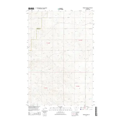
2014 Map of Freeman Creek
USGS Topo · Published 2014About this map
Dawson County and Wibaux County meet in this expansive section of eastern Montana, where the terrain is deeply etched by a network of seasonal drainages. These winding waterways, including Hodges Creek, Glendive Creek, and the eponymous Freeman Creek, carve through the high plains landscape, defining the local topography and historical travel routes. The map records a rural infrastructure of named roads such as Hodges Road and Beaver Hill Road that follow the natural rises and falls of the land.
Find a feature on this map
20 named features on this map. Tap any name to fly to it.
Don’t see what you’re looking for? This feature index may not catch every label — zoom into the map to look around manually.
Map Details
Editions of this 2014 Freeman Creek Map
This is the sole edition of this map. No revisions or reprints were ever made.
Other maps of this area

1909 · Glendive
USGS Topo · 1:250,000

1953 · Miles City
USGS Topo · 1:250,000

1954 · Glendive
USGS Topo · 1:250,000

1957 · Miles City
USGS Topo · 1:250,000

1957 · Glendive
USGS Topo · 1:250,000

1958 · Miles City
USGS Topo · 1:250,000

1958 · Glendive
USGS Topo · 1:250,000

1981 · Glendive
USGS Topo · 1:100,000

1981 · Wibaux
USGS Topo · 1:100,000
1982 · Hodges SE
USGS Topo · 1:24,000