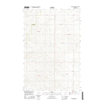
2017 Map of Freeman Creek
USGS Topo · Published 2017About this map
Hodges Cr and Glendive Cr wind through this high plains landscape at the eastern edge of Montana, marking a region defined by extensive ranching operations and remote road networks. The boundary between Dawson and Wibaux counties cuts through the northern sections, following the established township and range lines. The map reveals a highly structured rural infrastructure, where long stretches of Anvil Butte Rd and Hodges Rd provide the primary access to the scattered homesteads and ranch lands. To the south, Freeman Cr and Horse Cr drainage patterns indicate the local topography where seasonal waterways have carved out subtle coulees. This 2017 survey serves as a precise record of modern land divisions and access points in a sparsely populated section of the Montana-North Dakota borderlands, showing the continued importance of historic cattle routes and modern ranch access roads.
Find a feature on this map
19 named features on this map. Tap any name to fly to it.
Don’t see what you’re looking for? This feature index may not catch every label — zoom into the map to look around manually.
Map Details
Editions of this 2017 Freeman Creek Map
This is the sole edition of this map. No revisions or reprints were ever made.
Other maps of this area

1909 · Glendive
USGS Topo · 1:250,000

1953 · Miles City
USGS Topo · 1:250,000

1954 · Glendive
USGS Topo · 1:250,000

1957 · Miles City
USGS Topo · 1:250,000

1957 · Glendive
USGS Topo · 1:250,000

1958 · Miles City
USGS Topo · 1:250,000

1958 · Glendive
USGS Topo · 1:250,000

1981 · Glendive
USGS Topo · 1:100,000

1981 · Wibaux
USGS Topo · 1:100,000
1982 · Hodges SE
USGS Topo · 1:24,000