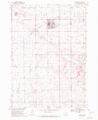
1970 Map of Freeman
USGS Topo · Published 1972About this map
Freeman serves as the central hub of this Hutchinson County landscape, centered around its grid-iron streets and the Chicago Milwaukee St Paul and Pacific railroad line. The presence of Freeman Jr College and the Freeman Cem indicates a well-established community during the early 1970s. The surrounding rural landscape is divided into townships like Grand View, Rosefield, and Valley, each defined by the presence of small country schools such as Brookside Sch and Huber Sch.
Find a feature on this map
18 named features on this map. Tap any name to fly to it.
Don’t see what you’re looking for? This feature index may not catch every label — zoom into the map to look around manually.
Map Details
Editions of this 1970 Freeman Map
This is the sole edition of this map. No revisions or reprints were ever made.
Other maps of this area

1898 · Olivet
USGS Topo · 1:125,000

1898 · Parker
USGS Topo · 1:125,000

1955 · Sioux Falls
USGS Topo · 1:250,000

1957 · Midway
USGS Topo · 1:24,000

1957 · Menno
USGS Topo · 1:24,000

1957 · Wolf Creek
USGS Topo · 1:24,000

1958 · Sioux Falls
USGS Topo · 1:250,000

1970 · Turkey Ridge
USGS Topo · 1:24,000

1970 · Clayton NE
USGS Topo · 1:24,000

1970 · Freeman SE
USGS Topo · 1:24,000