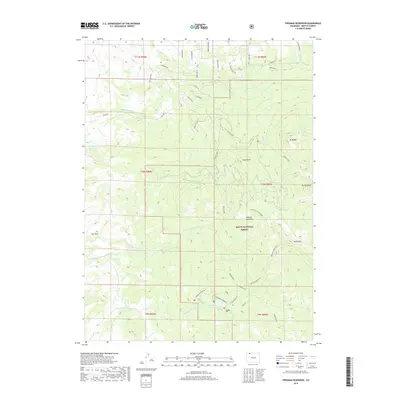
2019 Map of Freeman Reservoir
USGS Topo · Published 2019About this map
Routt National Forest dominates the high-altitude landscape of this Moffat County region, where the Elkhead Mountains rise to prominent peaks. The hydrology of the area is defined by the headwaters of Fortification Creek, which splits into the N Fork Fortification Cr and S Fork Fortification Cr. These drainages, alongside Little Cottonwood Cr and Willow Cr, create a complex network of seasonal and perennial waterways that have historically supported grazing and timber interests.
Find a feature on this map
49 named features on this map. Tap any name to fly to it.
Don’t see what you’re looking for? This feature index may not catch every label — zoom into the map to look around manually.
Map Details
Editions of this 2019 Freeman Reservoir Map
This is the sole edition of this map. No revisions or reprints were ever made.
Other maps of this area

1916 · Craig
USGS Topo · 1:125,000

1923 · Elkhead Creek
USGS Topo · 1:62,500

1924 · Elkhead Creek
USGS Topo · 1:62,500

1954 · Craig
USGS Topo · 1:250,000

1957 · Craig
USGS Topo · 1:250,000

1958 · Craig
USGS Topo · 1:250,000

1960 · Craig
USGS Topo · 1:250,000

1962 · Craig
USGS Topo · 1:250,000

1964 · Craig
USGS Topo · 1:250,000

1965 · Craig
USGS Topo · 1:250,000