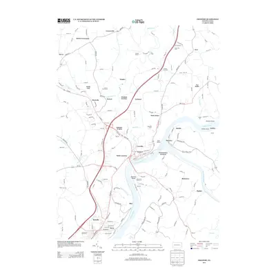
2013 Map of Freeport
USGS Topo · Published 2013About this map
Freeport sits at the vital confluence where the Allegheny River meets the Kiskiminetas River, serving as a central hub for river and rail activity in this 2013 survey. The landscape is defined by its industrial and transport lineage, featuring numerous junctions such as Kiskiminetas Junction, Butler Junction, and Winfield Junction. These points of connectivity reflect the historical importance of the river valleys in shaping movement through the region.
Find a feature on this map
149 named features on this map. Tap any name to fly to it.
Don’t see what you’re looking for? This feature index may not catch every label — zoom into the map to look around manually.
Map Details
Editions of this 2013 Freeport Map
This is the sole edition of this map. No revisions or reprints were ever made.
Other maps of this area

1900 · Kittanning
USGS Topo · 1:62,500

1902 · Kittanning
USGS Topo · 1:62,500

1907 · Freeport
USGS Topo · 1:62,500

1908 · New Kensington
USGS Topo · 1:62,500

1909 · Freeport
USGS Topo · 1:62,500

1909 · Butler
USGS Topo · 1:62,500

1910 · New Kensington
USGS Topo · 1:62,500

1911 · Butler
USGS Topo · 1:62,500

1953 · Pittsburgh
USGS Topo · 1:250,000

1953 · New Kensington East
USGS Topo · 1:24,000