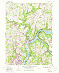
2023 Map of Freeport
USGS Topo · Published 2023About this map
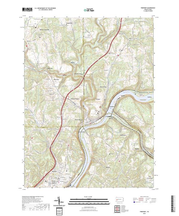
The confluence of the Allegheny River and Kiskiminetas River anchors this landscape at the border of Armstrong, Butler, and Allegheny Counties. The town of Freeport occupies the strategic northern bank, a historic hub defined by its proximity to the Three Rivers Water Trl and complex rail intersections. Rail heritage is evident at Butler Junction, Winfield Junction, and Kiskiminetas Junction, where the lines of the Conrail Rd navigate the steep river valleys. Away from the water, the plateau is marked by older crossroads and industrial settlements like Bricker Crossroads, Sarver, and Leasureville. Genealogists will find a high concentration of burial sites, including the Buffalo Presbyterian Church Cem, Saint Marys Cem, and Zion United Methodist Cem. The map also details the riparian terrain of Jacks Island and Murphy Island, alongside aviation history at Lindsay Airport.
Find a feature on this map
164 named features on this map. Tap any name to fly to it.
Don’t see what you’re looking for? This feature index may not catch every label — zoom into the map to look around manually.
Map Details
Editions of this 2023 Freeport Map
This is the sole edition of this map. No revisions or reprints were ever made.
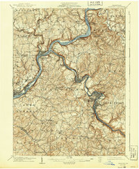
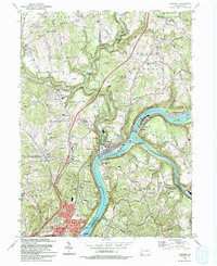
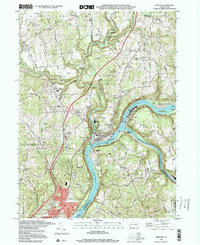
Historical Maps of Allegheny Township Through Time
6 maps found