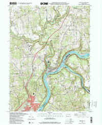
1998 Map of Freeport
USGS Topo · Published 2000About this map
The Allegheny River and Kiskiminetas River converge at Freeport, forming a complex industrial and transport hub at the intersection of Armstrong, Butler, Allegheny, and Westmoreland counties. This late-twentieth-century landscape is defined by the legacy of heavy infrastructure, from the Conrail and Pennsylvania Railroad lines hugging the riverbanks to the extensive Water Treatment Plant and Filtration Plant facilities. The map captures a mix of dense valley settlements like Schenley and Garvers Ferry alongside upland residential growth in Natrona Heights.
Find a feature on this map
73 named features on this map. Tap any name to fly to it.
Don’t see what you’re looking for? This feature index may not catch every label — zoom into the map to look around manually.
Map Details
Editions of this 1998 Freeport Map
This is the sole edition of this map. No revisions or reprints were ever made.
Other maps of this area

1900 · Kittanning
USGS Topo · 1:62,500

1902 · Kittanning
USGS Topo · 1:62,500

1907 · Freeport
USGS Topo · 1:62,500

1908 · New Kensington
USGS Topo · 1:62,500

1909 · Freeport
USGS Topo · 1:62,500

1909 · Butler
USGS Topo · 1:62,500

1910 · New Kensington
USGS Topo · 1:62,500

1911 · Butler
USGS Topo · 1:62,500

1953 · Pittsburgh
USGS Topo · 1:250,000

1953 · New Kensington East
USGS Topo · 1:24,000
Featured Places
- Harrison Township, PA
- Freeport, PA
- Buffalo Township, PA
- Winfield Township, PA
- South Buffalo Township, PA