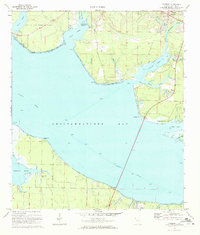
1970 Map of Freeport
USGS Topo · Published 1972About this map
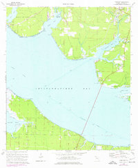
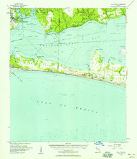
Choctawhatchee Bay dominates this coastal landscape, where the intricate shoreline of the Florida Panhandle is defined by numerous inlets and bayous. In the early 1970s, the settlement of Freeport is situated at the head of LaGrange Bayou, serving as a focal point for the surrounding creeks like Lafayette Creek and Fourmile Creek. To the west, the expansive Eglin Air Force Base occupies a significant portion of the peninsula, bordering Basin Bayou and Alaqua Bayou. The map illustrates the region's transition into a more developed coastal community, with Santa Rosa Beach taking shape along the southern shores near Hogtown Bayou. The presence of the Intracostal Waterway cutting through the bay emphasizes the area's importance for maritime transit, while smaller landmarks like the High Sch in Freeport and Lion Park reflect the local social infrastructure of the era.
Find a feature on this map
37 named features on this map. Tap any name to fly to it.
Don’t see what you’re looking for? This feature index may not catch every label — zoom into the map to look around manually.
Map Details
Editions of this 1970 Freeport Map
2 editions found
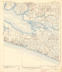
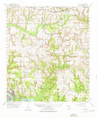
Other maps of this area

1934 · Niceville
USGS Topo · 1:48,000

1935 · Villa Tasso
USGS Topo · 1:48,000

1935 · De Funiak Springs
USGS Topo · 1:48,000

1936 · Niceville
USGS Topo · 1:62,500

1936 · Point Washington
USGS Topo · 1:48,000

1938 · Villa Tasso
USGS Topo · 1:62,500

1938 · De Funiak Springs
USGS Topo · 1:62,500
1939 · Point Washington
USGS Topo · 1:62,500
1956 · Niceville
USGS Topo · 1:62,500
1956 · Villa Tasso
USGS Topo · 1:62,500