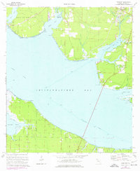
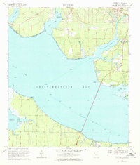
1970 Map of Freeport
USGS Topo · Published 1977About this map
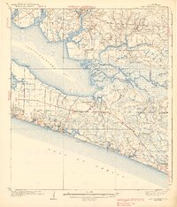
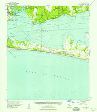
The town of Freeport sits at the head of La Grange Bayou, serving as a vital junction for the water-bound geography of Walton County. This coastal landscape is defined by the expansive Choctawhatchee Bay and the busy Intracoastal Waterway, which cuts across the southern portion of the sheet. To the northwest, the restricted lands of Eglin Air Force Base border Basin Bayou, illustrating the military presence that shaped land use in the Florida Panhandle during the mid-20th century.
Find a feature on this map
37 named features on this map. Tap any name to fly to it.
Don’t see what you’re looking for? This feature index may not catch every label — zoom into the map to look around manually.
Map Details
Editions of this 1970 Freeport Map
2 editions found
Other maps of this area

1934 · Niceville
USGS Topo · 1:48,000

1935 · Villa Tasso
USGS Topo · 1:48,000

1935 · De Funiak Springs
USGS Topo · 1:48,000

1936 · Niceville
USGS Topo · 1:62,500

1936 · Point Washington
USGS Topo · 1:48,000

1938 · Villa Tasso
USGS Topo · 1:62,500

1938 · De Funiak Springs
USGS Topo · 1:62,500
1939 · Point Washington
USGS Topo · 1:62,500
1956 · Niceville
USGS Topo · 1:62,500
1956 · Villa Tasso
USGS Topo · 1:62,500