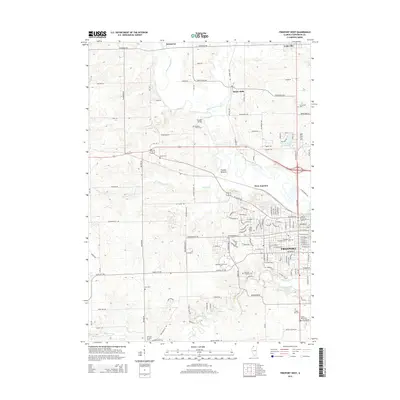
2015 Map of Freeport West
USGS Topo · Published 2015About this map
The Pecatonica River winds through the northwestern reaches of Freeport, anchoring a landscape where urban expansion meets the agricultural heart of Stephenson County. This 2015 survey illustrates the western development of the city, prominently featuring Highland Community College and the complex transportation junction at West Junction. The map is particularly rich for genealogical research, documenting numerous burial grounds ranging from the large Freeport City Cem and Oakland Freeport Cem to smaller family-named sites like Martin Cem and the Ellis Van Brocklin Cem. North of the city, the small settlements of Scioto Mills and Harlem Bridge sit along the riverbanks, while the meandering paths of Yellow Creek and Little Richard Creek define the drainage patterns of the surrounding farmland. The transition from grid-patterned city streets to the winding rural routes like Winneshiek Rd and Cedarville Rd reflects the enduring rural character just beyond the city limits.
Find a feature on this map
143 named features on this map. Tap any name to fly to it.
Don’t see what you’re looking for? This feature index may not catch every label — zoom into the map to look around manually.
Map Details
Editions of this 2015 Freeport West Map
This is the sole edition of this map. No revisions or reprints were ever made.
Other maps of this area

1937 · Lena
USGS Topo · 1:48,000

1939 · Freeport
USGS Topo · 1:48,000

1942 · Mt Carroll
USGS Topo · 1:62,500

1942 · Lena
USGS Topo · 1:62,500

1942 · Forreston
USGS Topo · 1:62,500

1943 · Lena
USGS Topo · 1:62,500

1944 · Mt Carroll
USGS Topo · 1:62,500

1944 · Freeport
USGS Topo · 1:62,500

1945 · Forreston
USGS Topo · 1:62,500

1954 · Rockford
USGS Topo · 1:250,000