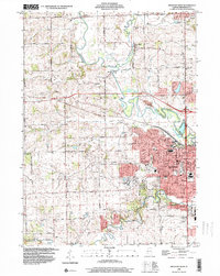
1998 Map of Freeport West
USGS Topo · Published 2000About this map
The Pecatonica River winds through the heart of this landscape, its tight oxbows defining the geography north of Freeport. In the late 1990s, this area of Stephenson County illustrates the convergence of agricultural tradition and institutional growth, anchored by the expansion of Highland Community College and its Technical Center. Settlement patterns follow the river and the path of the Chicago Central and Pacific Railroad, which connects the larger city to smaller rural outposts like Scioto Mills and West Junction. Genealogists will find a high density of small family and community burial grounds, including Martin Cem, Hart Cem, and Harlem Center Cem, often situated near early roads like West Preston Road. From the Scioto Hills to the industrial edges of the city, the map preserves the era's balance between the working Quarry sites and the civic spaces of Read Park.
Find a feature on this map
58 named features on this map. Tap any name to fly to it.
Don’t see what you’re looking for? This feature index may not catch every label — zoom into the map to look around manually.
Map Details
Editions of this 1998 Freeport West Map
This is the sole edition of this map. No revisions or reprints were ever made.
Other maps of this area

1937 · Lena
USGS Topo · 1:48,000

1939 · Freeport
USGS Topo · 1:48,000

1942 · Mt Carroll
USGS Topo · 1:62,500

1942 · Lena
USGS Topo · 1:62,500

1942 · Forreston
USGS Topo · 1:62,500

1943 · Lena
USGS Topo · 1:62,500

1944 · Mt Carroll
USGS Topo · 1:62,500

1944 · Freeport
USGS Topo · 1:62,500

1945 · Forreston
USGS Topo · 1:62,500

1954 · Rockford
USGS Topo · 1:250,000