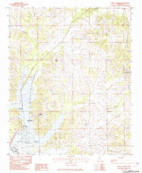
1982 Map of Frees Corners
USGS Topo · Published 1982About this map
Arkabutla Lake dominates the southern landscape of this 1982 survey, where the Coldwater R meets an intricate network of tributaries. The map details the expansive Arkabutla State Waterfowl Refuge and various recreational zones like the Plantation Point Public Use Area, highlighting a region defined by water management and conservation. The terrain is marked by numerous small stream valleys, including Mussacuna Creek and Hurricane Creek, which drain into the reservoir.
Find a feature on this map
20 named features on this map. Tap any name to fly to it.
Don’t see what you’re looking for? This feature index may not catch every label — zoom into the map to look around manually.
Map Details
Editions of this 1982 Frees Corners Map
2 editions found
Other maps of this area

1908 · Lake Cormorant
USGS Topo · 1:24,000

1912 · Lake Cormorant
USGS Topo · 1:31,680

1932 · Horn Lake
USGS Topo · 1:48,000

1932 · Crenshaw
USGS Topo · 1:62,500

1935 · Crenshaw
USGS Topo · 1:62,500

1935 · Horn Lake
USGS Topo · 1:62,500

1944 · Senatobia
USGS Topo · 1:62,500

1944 · Hernando
USGS Topo · 1:62,500

1948 · Helena
USGS Topo · 1:250,000

1950 · Helena
USGS Topo · 1:250,000