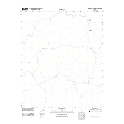
2011 Map of Freezeout Mountain
USGS Topo · Published 2011About this map
The Black River defines the northern boundary of this high-altitude landscape in eastern Arizona, where a network of seasonal drainages and canyons carve through the terrain. Named features such as Arkie Canyon, Helen Canyon, and Little Bear Canyon reveal the intricate topography of the region. The high ground is anchored by Freezeout Mountain, with several notable passes including BS Gap and Malay Gap facilitating travel across the ridges. Water management is central to the land's utility, evidenced by numerous tanks used for livestock or wildlife, such as Cox Corral Tank, Loafer Tank, and Buckhorn Tank. These water sources, along with Rose Spring, represent critical points for local geography in a landscape defined by ephemeral flows like Dry Prong Creek and Malay Creek.
Find a feature on this map
19 named features on this map. Tap any name to fly to it.
Don’t see what you’re looking for? This feature index may not catch every label — zoom into the map to look around manually.
Map Details
Editions of this 2011 Freezeout Mountain Map
This is the sole edition of this map. No revisions or reprints were ever made.
Other maps of this area

1913 · Morenci
USGS Topo · 1:125,000

1915 · Morenci
USGS Topo · 1:125,000

1922 · Nutrioso
USGS Topo · 1:125,000

1954 · Clifton
USGS Topo · 1:250,000

1957 · Clifton
USGS Topo · 1:250,000

1958 · Clifton
USGS Topo · 1:250,000

1958 · Hannagan Meadow
USGS Topo · 1:62,500

1962 · Clifton
USGS Topo · 1:250,000

1967 · Freezeout Mountain
USGS Topo · 1:24,000

1967 · Robinson Mesa
USGS Topo · 1:24,000