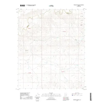
2018 Map of Freezeout Mountain
USGS Topo · Published 2018About this map
Black River carves through the northern reaches of this high-country landscape along the border of Apache Co and Graham Co. The terrain is defined by a series of significant drainages and canyons, including Helen Canyon, Arkie Canyon, and Little Bear Canyon, which descend toward the river valley. Central to the topography is the prominent Freezeout Mtn, a landmark surrounded by intricate seasonal waterways like Freezout Cr and Dry Prong Cr.
Find a feature on this map
24 named features on this map. Tap any name to fly to it.
Don’t see what you’re looking for? This feature index may not catch every label — zoom into the map to look around manually.
Map Details
Editions of this 2018 Freezeout Mountain Map
This is the sole edition of this map. No revisions or reprints were ever made.
Other maps of this area

1913 · Morenci
USGS Topo · 1:125,000

1915 · Morenci
USGS Topo · 1:125,000

1922 · Nutrioso
USGS Topo · 1:125,000

1954 · Clifton
USGS Topo · 1:250,000

1957 · Clifton
USGS Topo · 1:250,000

1958 · Clifton
USGS Topo · 1:250,000

1958 · Hannagan Meadow
USGS Topo · 1:62,500

1962 · Clifton
USGS Topo · 1:250,000

1967 · Freezeout Mountain
USGS Topo · 1:24,000

1967 · Robinson Mesa
USGS Topo · 1:24,000