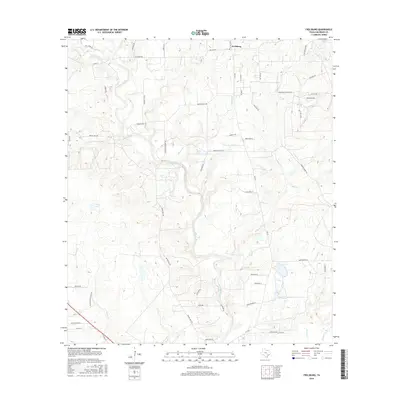
2016 Map of Frelsburg
USGS Topo · Published 2016About this map
Frelsburg sits at the northern edge of this Colorado County landscape, where the coastal prairie begins to transition into more varied drainage patterns. The terrain is defined by the winding course of Cummins Creek, which is fed by numerous smaller tributaries including Piper Cr, Plum Br, and Bee Br. This network of waterways historically influenced the placement of early infrastructure, evidenced by roads like Dungens Mill Rd and Brunes Mill Rd that hint at the area's mid-19th-century agricultural and milling heritage. In the southwestern portion of the map, Cullen Lake provides a notable landmark amidst a series of creeks such as Yupon Cr and Dry Cr. The road network, featuring names like Zimmerscheidt Rd and Venghaus George Rd, reflects the deep-rooted German-Texan family history that has shaped this part of the state for generations.
Find a feature on this map
58 named features on this map. Tap any name to fly to it.
Don’t see what you’re looking for? This feature index may not catch every label — zoom into the map to look around manually.
Map Details
Editions of this 2016 Frelsburg Map
This is the sole edition of this map. No revisions or reprints were ever made.
Other maps of this area

1919 · Fayettsville
USGS Topo · 1:62,500

1953 · Seguin
USGS Topo · 1:250,000

1956 · Bellville
USGS Topo · 1:62,500

1956 · Glidden
USGS Topo · 1:62,500

1957 · Eagle Lake
USGS Topo · 1:62,500

1957 · Ellinger
USGS Topo · 1:24,000

1957 · Columbus
USGS Topo · 1:24,000

1957 · Borden
USGS Topo · 1:24,000

1958 · Seguin
USGS Topo · 1:250,000

1958 · Industry
USGS Topo · 1:24,000