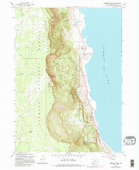
1966 Map of Fremont Point
USGS Topo · Published 1995About this map
Winter Ridge dominates this high-desert landscape, rising sharply above the western shoreline of Summer Lake. The dramatic elevation change between the lake bed and the Fremont National Forest is punctuated by geological and historical markers, most notably the Old Indian Treaty Bdy which traverses the ridge line. This boundary provides a clear spatial record of 19th-century land divisions across the high plateau.
Find a feature on this map
21 named features on this map. Tap any name to fly to it.
Don’t see what you’re looking for? This feature index may not catch every label — zoom into the map to look around manually.
Map Details
Editions of this 1966 Fremont Point Map
3 editions found
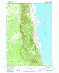
Other maps of this area

1955 · Klamath Falls
USGS Topo · 1:250,000

1958 · Klamath Falls
USGS Topo · 1:250,000

1966 · Summer Lake
USGS Topo · 1:24,000

1966 · Shake Butte
USGS Topo · 1:24,000

1966 · Slide Mtn
USGS Topo · 1:24,000

1966 · Harvey Creek
USGS Topo · 1:24,000

1966 · Fremont Point
USGS Topo · 1:24,000

1966 · Pole Butte
USGS Topo · 1:24,000

1966 · Foster Butte
USGS Topo · 1:24,000

1974 · Lake Abert
USGS Topo · 1:100,000