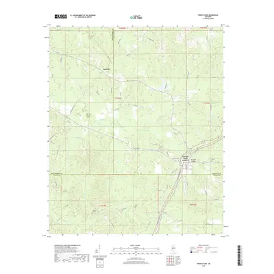
2018 Map of French Camp
USGS Topo · Published 2018About this map
The Natchez Trace Parkway serves as the primary corridor through this portion of Choctaw and Montgomery Counties, tracking a path north toward French Camp. This community is a hub of local history, evidenced by the clustered presence of the French Camp Cem and the nearby Hemphill Cem. Further north, the settlement of Huntsville sits at a junction of rural roads including Stewart-Huntsville Rd and Huntsville Rd.
Find a feature on this map
67 named features on this map. Tap any name to fly to it.
Don’t see what you’re looking for? This feature index may not catch every label — zoom into the map to look around manually.
Map Details
Editions of this 2018 French Camp Map
This is the sole edition of this map. No revisions or reprints were ever made.
Other maps of this area

1953 · West Point
USGS Topo · 1:250,000

1958 · West Point
USGS Topo · 1:250,000

1963 · West Point
USGS Topo · 1:250,000

1964 · Kosciusko NE
USGS Topo · 1:24,000

1966 · Kilmichael
USGS Topo · 1:24,000

1966 · Poplar Creek
USGS Topo · 1:24,000

1966 · Kosciusko
USGS Topo · 1:62,500

1966 · Stewart
USGS Topo · 1:24,000

1966 · Weir
USGS Topo · 1:24,000

1966 · Tomnolen
USGS Topo · 1:24,000