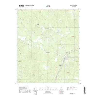
2020 Map of French Camp
USGS Topo · Published 2020About this map
The Natchez Trace Parkway serves as the primary corridor through this section of rural Mississippi, following a north-south path through the center of French Camp. This community and the smaller settlement of Huntsville to the north represent the primary centers of habitation, situated amidst a landscape heavily divided by county and township boundaries. The map reveals a complex network of waterways including Poplar Creek, Wolf Creek, and Davidson Creek, which define the local drainage patterns near the intersection of Choctaw, Montgomery, and Attala Counties.
Find a feature on this map
65 named features on this map. Tap any name to fly to it.
Don’t see what you’re looking for? This feature index may not catch every label — zoom into the map to look around manually.
Map Details
Editions of this 2020 French Camp Map
This is the sole edition of this map. No revisions or reprints were ever made.
Other maps of this area

1953 · West Point
USGS Topo · 1:250,000

1958 · West Point
USGS Topo · 1:250,000

1963 · West Point
USGS Topo · 1:250,000

1964 · Kosciusko NE
USGS Topo · 1:24,000

1966 · Kilmichael
USGS Topo · 1:24,000

1966 · Poplar Creek
USGS Topo · 1:24,000

1966 · Kosciusko
USGS Topo · 1:62,500

1966 · Stewart
USGS Topo · 1:24,000

1966 · Weir
USGS Topo · 1:24,000

1966 · Tomnolen
USGS Topo · 1:24,000