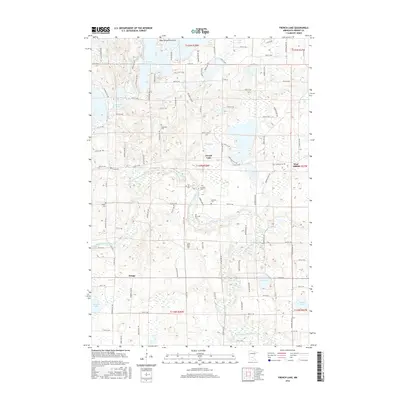
2016 Map of French Lake
USGS Topo · Published 2016About this map
French Lake and the small settlements of West Albion and Knapp anchor this Wright County landscape, characterized by the winding path of the North Fork Crow River. The river cuts a slow course through the southern half of the quadrangle, while the northern reaches are dominated by glacial water bodies, including Dans Lake, E Lake Sylvia, and the prominent Lake Sylvia Peninsula. The density of community landmarks suggests a long-established rural network, particularly evident in the high concentration of cemeteries such as Saint Ignatius Cem, Our Savior Cem, and Crow River Cem. These sites, often paired with country churches, provide a clear record of local genealogy and the early social centers of the township. A robust grid of county roads, including Co Hwy 38 and Co Rd 37 NW, connects these scattered settlements across the undulating terrain between Moose Lake and Mud Lake.
Find a feature on this map
61 named features on this map. Tap any name to fly to it.
Don’t see what you’re looking for? This feature index may not catch every label — zoom into the map to look around manually.
Map Details
Editions of this 2016 French Lake Map
This is the sole edition of this map. No revisions or reprints were ever made.
Other maps of this area

1951 · Annandale
USGS Topo · 1:62,500

1953 · Saint Cloud
USGS Topo · 1:250,000

1957 · Saint Cloud
USGS Topo · 1:250,000

1958 · Saint Cloud
USGS Topo · 1:250,000

1958 · Dassel
USGS Topo · 1:62,500

1958 · Cokato
USGS Topo · 1:62,500

1967 · Kimball
USGS Topo · 1:24,000
1974 · Annandale
USGS Topo · 1:24,000
1974 · South Haven
USGS Topo · 1:24,000
1982 · Dassel
USGS Topo · 1:24,000