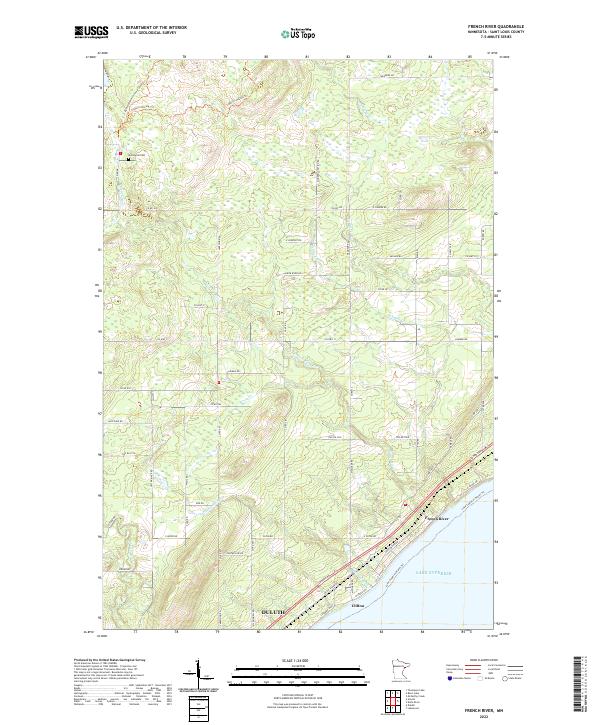
2022 Map of French River
USGS Topo · Published 2022About this map
Lake Superior dominates the southeastern boundary of this map, where the coastal communities of French River and Clifton sit along the shoreline. This contemporary survey illustrates the dense network of county roads and residential throughways that connect the lakefront to the higher elevations inland. The Duluth city limits extend into the southwestern corner, reflecting the outward growth of the regional hub.
Find a feature on this map
64 named features on this map. Tap any name to fly to it.
Don’t see what you’re looking for? This feature index may not catch every label — zoom into the map to look around manually.
Map Details
Editions of this 2022 French River Map
This is the sole edition of this map. No revisions or reprints were ever made.
Other maps of this area

1895 · Duluth
USGS Topo · 1:62,500

1953 · Lakewood
USGS Topo · 1:24,000

1953 · French River
USGS Topo · 1:24,000

1953 · Arnold
USGS Topo · 1:24,000

1953 · Duluth
USGS Topo · 1:24,000

1953 · Knife River
USGS Topo · 1:24,000

1953 · Duluth
USGS Topo · 1:62,500

1953 · Ashland
USGS Topo · 1:250,000

1953 · Duluth
USGS Topo · 1:250,000

1954 · Barrs Lake
USGS Topo · 1:24,000