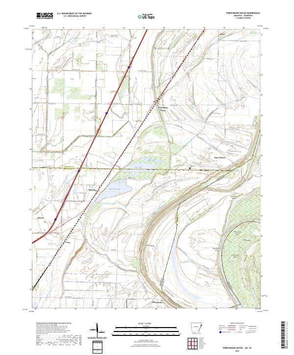
2024 Map of Frenchmans Bayou
USGS Topo · Published 2024About this map
Frenchmans Bayou flows through a landscape defined by the shifting meanders and oxbow lakes of the Mississippi River delta. This modern survey illustrates a network of small agricultural settlements and crossroads including Joiner, Saint Thomas, and Meneshea, which are linked by local connectors like State Hwy 308 and Old River Rd. The intricate hydrology of the region is evident in the presence of Mink Lake, Stave Lake, and Meneshea Lake, remnants of the river's historical path. Near the state boundary, the map details the complex geography of Centennial Island and Brandywine Island, separated by the dramatic curve of Centennial Bend. Genealogical interest is anchored by the Rupe Cem and the scattered hamlets of Lambethville and Stacy, providing a clear view of current property boundaries and rural infrastructure in Mississippi and Crittenden counties.
Find a feature on this map
60 named features on this map. Tap any name to fly to it.
Don’t see what you’re looking for? This feature index may not catch every label — zoom into the map to look around manually.
Map Details
Editions of this 2024 Frenchmans Bayou Map
This is the sole edition of this map. No revisions or reprints were ever made.
Other maps of this area

1931 · Jericho
USGS Topo · 1:62,500

1939 · Jericho
USGS Topo · 1:62,500

1939 · Evadale
USGS Topo · 1:62,500

1940 · Deckerville
USGS Topo · 1:62,500

1941 · Marked Tree
USGS Topo · 1:62,500

1952 · Jericho
USGS Topo · 1:62,500

1953 · Memphis
USGS Topo · 1:250,000

1956 · Evadale
USGS Topo · 1:62,500

1956 · Marked Tree
USGS Topo · 1:62,500

1956 · Memphis
USGS Topo · 1:250,000